Modding
From Dark Omen Wiki
(Difference between revisions)
(Modding moved to Dark Omen:Modding) |
(Better images, upload to wiki and replace in thumbnails) |
||
| (5 intermediate revisions not shown) | |||
| Line 1: | Line 1: | ||
| - | + | ==Warhammer: Shadow of the Horned Rat== | |
| + | {{see|title=Main article is at|SotHR/Modding}} | ||
| + | '''[[Warhammer: Shadow of the Horned Rat]]''' tend to use plain-text data files. The main battle data is stored in the BTS (Battle Script) file. | ||
| + | |||
| + | ==Warhammer: Dark Omen== | ||
| + | {{see|title=Main article is at|DO/Modding}} | ||
| + | '''[[Warhammer: Dark Omen]]''' is an evolution of ''SotHR'' and has inherited much of the the general structure of its predecessor, with the difference that most data files are in binary rather than text format. | ||
| + | |||
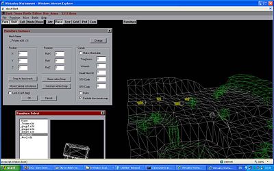
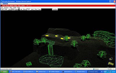
| + | The graphics of a Dark Omen map consists of a terrain 3D model (in a file with the name BASE.M3X, which also contains some terrain geometry sub-models unique to the map and a water model named ??water.m3d which is placed on top of the terrain model as is shown in these two historical images of the map B1_01 in the original developers' editor (which unfortunately is not available to us): | ||
| + | |||
| + | <center> | ||
| + | [[Image:Editorwd5.jpg|400px]] | ||
| + | [[image:Editor2uc2.jpg|400px]] | ||
| + | </center> | ||
| + | |||
| + | |||
| + | |||
| + | |||
| + | http://img84.imageshack.us/img84/7244/originaleditor2zp1.jpg | ||
| + | http://img242.imageshack.us/img242/1638/originaleditorsh4.jpg | ||
Current revision as of 23:43, 29 January 2009
Warhammer: Shadow of the Horned Rat
- Main article is at: SotHR/Modding
Warhammer: Shadow of the Horned Rat tend to use plain-text data files. The main battle data is stored in the BTS (Battle Script) file.
Warhammer: Dark Omen
- Main article is at: DO/Modding
Warhammer: Dark Omen is an evolution of SotHR and has inherited much of the the general structure of its predecessor, with the difference that most data files are in binary rather than text format.
The graphics of a Dark Omen map consists of a terrain 3D model (in a file with the name BASE.M3X, which also contains some terrain geometry sub-models unique to the map and a water model named ??water.m3d which is placed on top of the terrain model as is shown in these two historical images of the map B1_01 in the original developers' editor (which unfortunately is not available to us):


